Pistacchio gelato sitting on a pier overlooking a pastel-hued port in Croatia.
Vespa rides along Italy’s winding coastal roads, passing cliffside houses and imposing Renaissance palaces. Lounging on an exclusive beach club in Nice, France, spritz in hand and not a care in the world.
Sounds dreamy, alright, until you factor in the buzzing crowds, jammed traffic leading to most beach spots, and the AC-equipped room budget alone.
Yep, there’s no way you can survive in the Southern European heat without it, and those don’t come cheap in all of the trendiest coastal destinations.
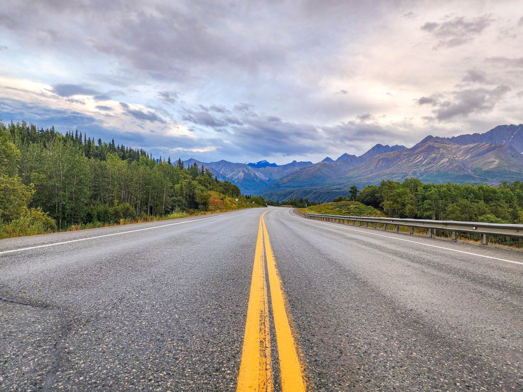
If melting under 95 degrees, spraying sunscreen all over yourself every 2 hours, and gasping for air every 10 steps up the next hilltop panorama doesn’t sound like your idea of fun this year, we have good news for you: there’s a cooler, much-milder European summer in Central and Northern Europe.
Here are 5 alternatives to the Mediterranean humdrum that won’t leave you fried, dehydrated, and facing an imminent skin cancer risk in your early 40s:
PLUS: We’ve created an interactive quiz for you at the end of this article to find which destination is perfect for you!
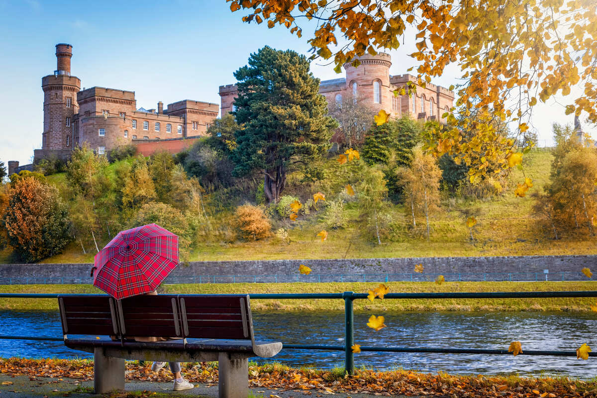
Inverness, Scotland
The quiet, unassuming capital of the Scottish Highlands, Inverness is still largely undiscovered by most UK-bound tourists, which is a shame, because it could easily step right out of a storybook.
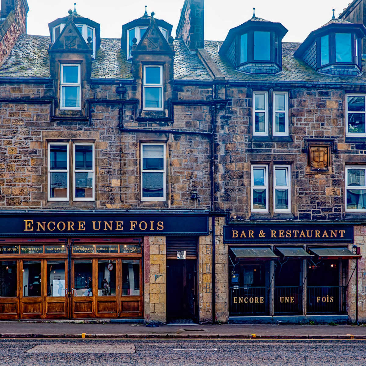
Perched on the northern shores of Loch Ness, the mystical lake said to harbor a serpent-like monster, the city boasts a gorgeous historic castle overlooking a café-lined waterfront, lively shopping streets flanked by Georgian buildings, and charming little corners made for wandering.
Inverness is rather rainy and breezy year-round, even in summer, so pack a light rain jacket. But the good news? Even if it starts “pissing down,” as the Scots say, it’s rarely for long. Sunshine, and often a beautiful rainbow is likely to follow the Northerly downpour.
The hottest it usually gets this far north in Britain is around 65°F, dropping to 50°F in the evenings.
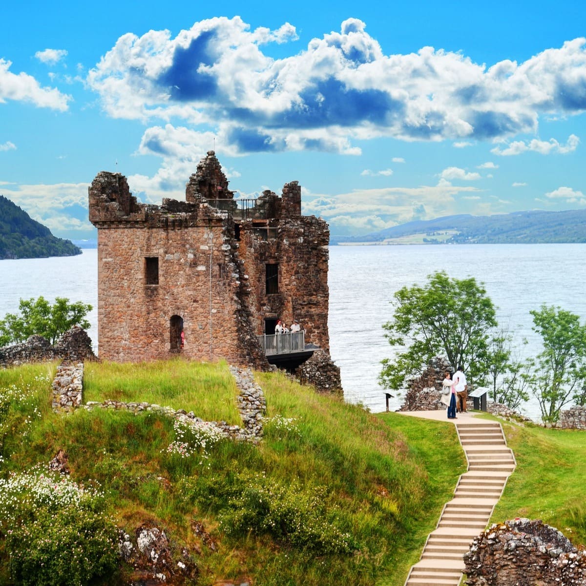
A short 30-minute drive brings you to Urquhart Castle, one of Britain’s most scenic castle ruins, right on Loch Ness’ shores. Even closer, just 15 minutes out of town, the Culloden Battlefield marks the historic 1746 Jacobite uprising.
Venture a bit further, and the Cairngorms offer hiking paths and stunning forested scenery. For a full-day adventure, roughly 3 hours each way, the Isle of Skye is Scotland’s ultimate island escape, complete with fairy pools, towering waterfalls plunging into the ocean, and romantic castles.
The U.K. and Europe in general have recently changed their entry rules for American tourists, and this includes Scotland. Bringing a valid passport to the airport is no longer sufficient to be allowed boarding in UK-bound flights.
Check the latest Entry Requirements here.
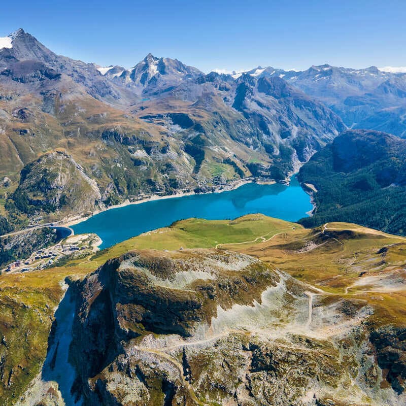
Tignes, France

One of the highest settlements in Europe, perched on a glacial plateau about 3,030 meters above sea level, Tignes is basically the top move if you want to escape the summer heat in July. Think daytime highs around 62°F and nighttime lows near 40°F.
Aka perfect “I can finally wear a jacket again” weather.
It’s best known in winter for its winding red pistes and reliable snow, but in summer, the whole place flips into a hiker’s and biker’s paradise. You’ve got well-marked trails leading to uncrowded, crystal-clear lakes, wildflower-covered slopes, and ridiculous views of snow-capped peaks in every direction.
The Vanoise area is packed with 40+ bike trails, ridgelines, and alpine routes, and honestly, that’s probably the main reason to go in summer. Riding through all that lush green scenery with the Alps looming in the background is kind of unreal.
And even if you’re not exactly trying to break a sweat, you can still get the full alpine experience. Just hop on the “Snowpiercer” funicular from Val Claret, the highest part of Tignes, up toward the Grande Motte glacier.
The views are straight-up magical, and there’s a very deserved apéro waiting for you at the top.
My favorite part about Tignes? It’s considerably safer, more family-oriented, and a higher-trust society than what Paris, Marseille, Lyon, and most French powerhouse cities have become. None of the scamming, street violence, or low security levels.
You’re not just breathing fresh, crisp mountain air. You’re actually breathing unbothered.
How Dangerous Is Paris Right Now?
Currently, our Traveler Safety Index shows Paris sitting at an 81/100 based on recent travelers’ votes.
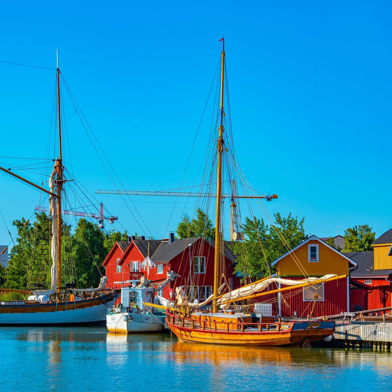
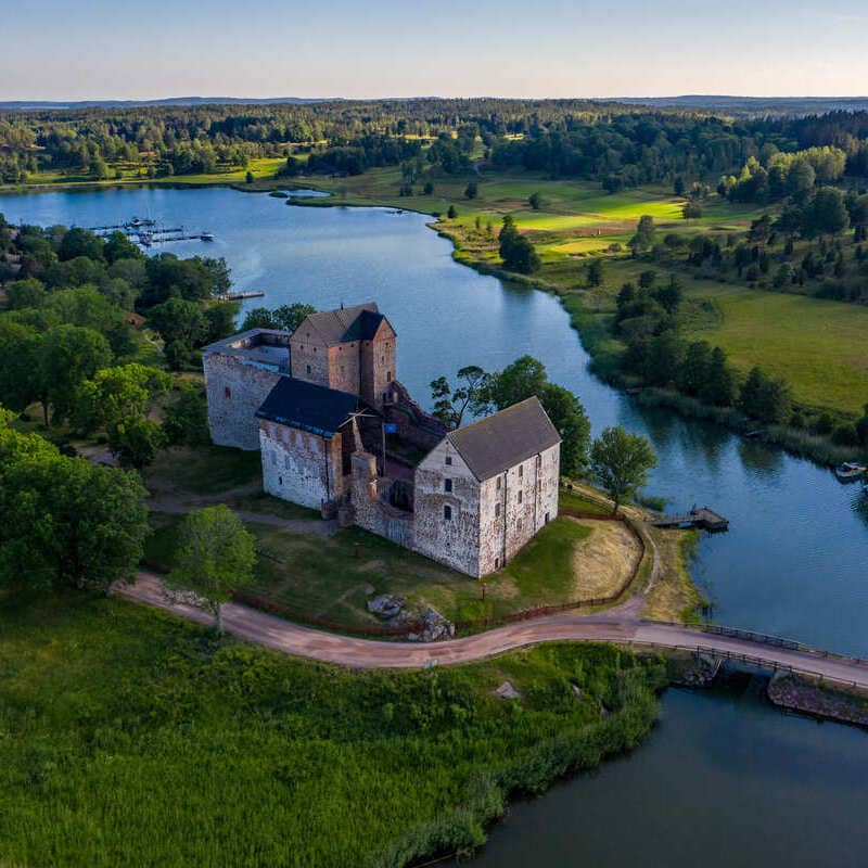
Åland
Autonomous Territory Of Finland
If you’ve read our recent article 4 Of The Weirdest But Also Coolest Places To Visit In Europe, you probably know by now we have a soft spot for the odd geopolitical anomaly.
Åland is an island that lies off the coast of Sweden, and given a majority of the residents proudly identify as, and speak Swedish as their mother language, you’d expect it to be part of the Scandinavian kingdom… right?
Wrong answer. Finland is the sovereign power here.
Though Åland enjoys a high degree of autonomy, being responsible for its own government, education, and internal affairs, it’s officially part of Finland, and Finnish citizenship applies.
It’s also an island in the middle of the icy Baltic Sea, so you might want to give it a miss right now if you hate strong winds and gray, moody weather; this probably isn’t the right time to go.
In summer, though? Completely different story: when the sun shines, it turns into a paradise for biking, with flat, easy cycling routes, and it’s probably Europe’s most underrated natural getaway, from the red granite shores to the castle-dotted pine forests inland.
Mariehamn, the small but charming capital, is ridiculously cute, with its colorful, chalet-style wooden townhouses, and that classic sea-then-sauna combo that’s just the ultimate Nordic flex.
Weather-wise, you’ll still want to pack at least a few sweaters, because even in July, the hottest it usually gets is around 67°F.
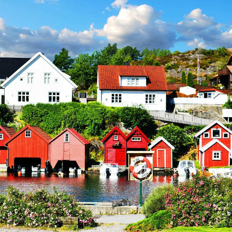
Kristiansand, Norway
Sticking to the Nordics, you probably know by now that Norway is the go-to destination for escaping the heat, but tourists usually flock to Oslo, Bergen, and the Ålesund fjords up north. Let’s face it: you don’t want Italy’s blazing sun, but you also don’t want to be freezing cold on your one year summer getaway.
In that case, the picture-perfect Kristiansand is the top pick. Highs: 66–72°F. Lows: 52–57°F.
It has the postcard-ready harbor, the white wooden houses flanking narrow cobbled streets, particularly around the Posebyen district, and the unrivaled café culture you can only dream of in America. Craving those fluffly, sugar-sprinkled Norwegian cinnamon buns?
Check out Raccoon right in the heart of town.
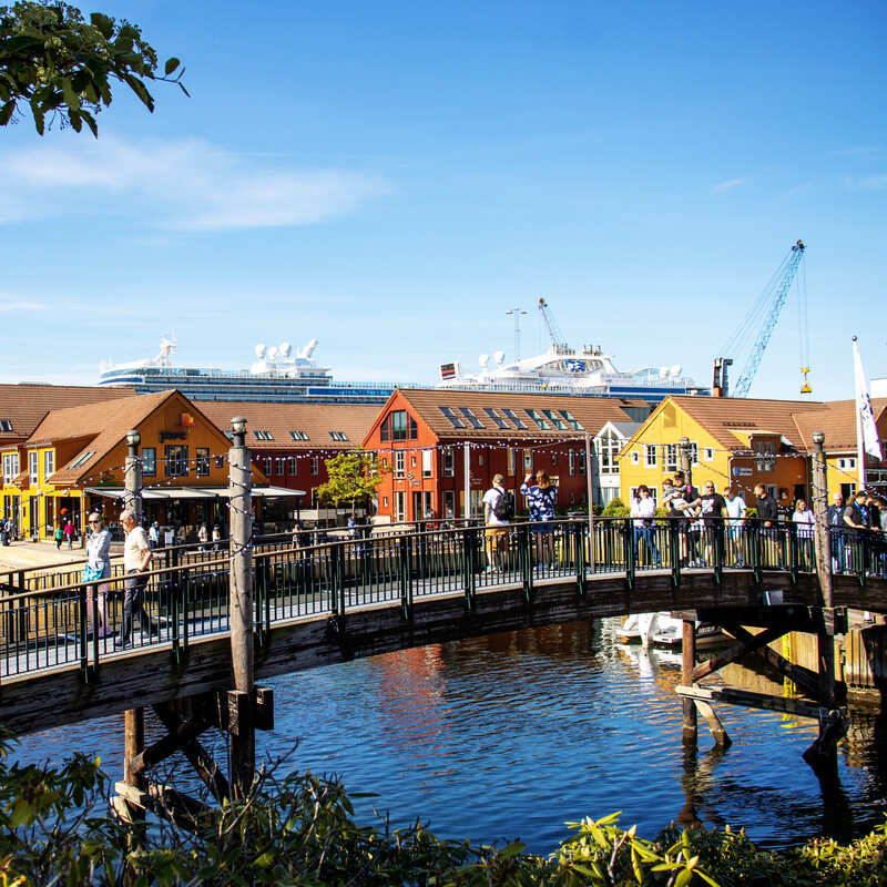
In sum, Kristiansand is one of the easiest, prettiest, most chill summer cities in Norway, and the fact it straddles the southern coast makes it that much sunnier than your average Norwegian port town. Brits have Brighton, the French have Nice, Norwegians have Kristiansand.
Additionally, it is a perfect gateway to the Sørlandet Coast, known for its coastal skerries and little islands, sandy beaches, and laid-back coastal charm…
But no tall, epic fjords like Sognefjord or Geirangerfjord.
For that, you might want to head farther north.
Check Travel Rules Before Flying To Europe This Summer

By the way, if you’ve been reading the news lately, you probably know Americans will start getting fingerprinted when traveling to Europe this summer.
A big misconception among tourists is that this only applies to the European Union, of which Norway is not a member.
Wrong. It applies to all countries within the Schengen Zone, in which Norway participates.
If you’re heading to the Scandinavian country in the near future, make sure you double-check the latest entry requirements that apply on the date of your arrival here.
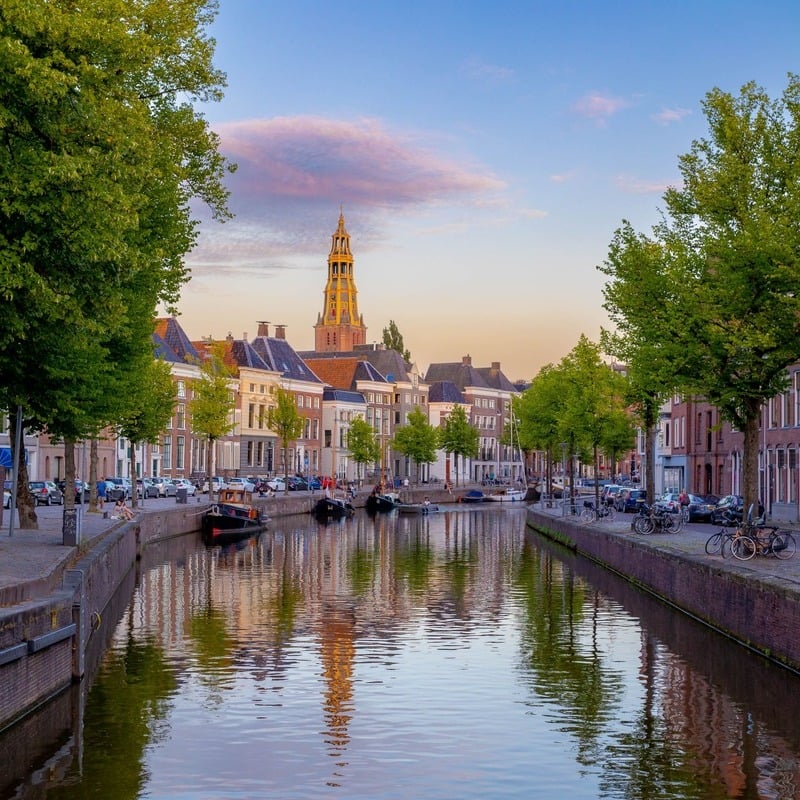
Groningen, Netherlands
What most travelers don’t know is that they don’t necessarily need to go to the ‘Dam, and elbow their way through the maddening crowds, or choke in a haze of skunk smoke, to experience Dutch culture… nor suffer through the Paris and Rome heat.
Groningen, in the north of the Netherlands, is a much better pick.
Still big enough of a city, with a thriving uni student scene, your usual mix of downtown bars and nightclubs, yet at the same time, quieter, more local, and definitely not as tourist-saturated as Amsterdam’s Red Light District or packed museums.

You’ll be wandering in short shorts and a light jacket along gorgeous canals, admiring traditional Northern Mannerist houses, with their slender figures and stepped roofs, and hidden courtyards, and it will rarely ever be warmer than 70°F, or colder than 55°F.
It’s definitely not hot enough for beach-level sunbathing, but ideal for cycling, Old Town strolls, and chill café terrace moments.
Don’t miss Martini Tower, the big, medieval bell tower towering above the maze-like center: you can climb it for panoramic views of town and its verdant countryside.
On April 6, 2026, Amsterdam Centraal experienced delays due to overcrowding and operational restrictions. Travelers were urged to allow extra time for train connections.
Before flying, make sure to check the latest Travel Alerts for the Netherlands.
Now take this quiz to find your perfect match!
Question 1 of 3
What landscape is calling your name?
Question 2 of 3
What is your ideal “Cool” summer vibe?
Final Question
Which activity tops your 2026 itinerary?
Inverness, Scotland
The Storybook Highland Escape
Tip: Pack a rain jacket for the “Northerly downpour” and visit Urquhart Castle for iconic Loch Ness photos.
Tignes, France
The High-Trust Alpine Sanctuary
Tip: Take the funicular to the Grande Motte glacier for a high-altitude apéro with zero “tourist chaos.”
Åland, Finland
The Geopolitical Island Gem
Tip: Don’t miss the sea-then-sauna combo in Mariehamn—it’s the ultimate Nordic summer flex.
Kristiansand, Norway
The “Nice” of the Nordics
Tip: Wander the Posebyen district and grab a sugar-sprinkled cinnamon bun at Racoon.
Groningen, Netherlands
The Uncrowded Dutch Alternative
Tip: Climb the Martini Tower for views of the countryside, away from the haze of Amsterdam.

Stacie Harris is a local resident and reporter of the Maple Grove area. Stacie reports on medicine and science for the Maple Grove Report.