Data centers in Minnesota: The next big election issue


Driving down a dirt road that runs along a sprawling farm field, Aubree Derksen described feeling like David against Goliath. 

Her Goliath is Google, the tech behemoth working with a developer to transform that rural field into a hyperscale data center. From Derksen’s nearby home in Pine Island, conspicuous for its anti-data center signage, she mounts local opposition to the plans.

She has allies around town and across the state. Together, they make up a grassroots coalition of Minnesotans working to stop projects in Pine Island, Farmington, Hermantown, Monticello and other cities.

They say local governments are too charmed by the promises of economic development to heed resident concerns about the health, environmental and resource-management risks posed by data centers. 

Despite their vocal protests, proposed developments hummed through local regulatory processes over the past two years — unless court orders forced them to pause, as they did in Pine Island and Faribault. Higher up the elected office chain, a host of bills seeking to rein in data center proposals failed at the Legislature last session.

“That was incredibly disappointing,” Derksen said.

But campaign season presents another opportunity. With city, county and state offices in the balance across Minnesota this fall, Derksen said data centers should be seen as a key election issue. 

“This is the new single-issue voter,” she said. “It’s not going to be abortion or LGBTQ or immigration issues. I think it’s going to be data centers, and I think that’s something both parties are going to have to reckon with.” 

The politics of data centers

Spurred by a groundswell of fired up residents, the reckoning started at the DFL and GOP state conventions last month. 

Two data center resolutions garnered broad support from DFL delegates. A moratorium drew 64% of the votes, while a more conciliatory (and palatable to labor unions) resolution focused on tighter regulations came in at 76%. The latter was second only to Boundary Waters’ protections in its popularity among DFLers. 

By no means a local government gadfly before she caught wind of data centers, Derksen was a first-time delegate. So, too, was Cathy Johnson, a retired teacher turned activist against a project in Farmington.

Ellen Schmidt/MinnPost/CatchLight Local/Report for America
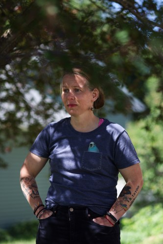
Pine Island resident and activist Aubree Derksen stands on her deck on Friday, June 12, 2026, in Pine Island, Minn. Derksen, a former Minneapolis resident, said part of the reason she moved to small-town Minnesota was to be able to sit out on her deck and watch the stars in silence. She says the “Project Skyway” data center threatens that, as it would be less than a mile from her home. Credit: Ellen Schmidt/MinnPost/CatchLight Local/Report for America

“I was really enjoying my retirement,” Johnson said. “I just felt like these are such egregious projects that I could not just sit by. I needed to be involved.” 

Johnson leads a group known as the Coalition for Responsible Data Center Development. She came to the cause from an environmentalist angle, seeing data centers as an unnecessary risk to local energy and water resources.

A place under the DFL’s tent is the natural fit for her, although party lawmakers are far from unified on data centers. Pro-business moderates, labor groups and environmentalists differ in what, if any, solutions are needed.

The issue simply doesn’t fit within an easily definable, partisan box, according to recent polling.

Although it’s Democrats who are most concerned about the environmental impacts of data centers, most Republicans also share that sentiment, an Ipsos poll found. Republicans oppose government restrictions on data centers more than Democrats do, but conservatives are quite split on the question.

Overall, the pollster concluded that:

“Partisan rifts on data centers come from unsurprising areas. Republicans have a stronger inclination for a more free-market approach, while Democrats are more cautious about environmental impacts. And while Republicans are slightly more optimistic about data centers, overall support for their construction remains low.”

  • Ellen Schmidt/MinnPost/CatchLight Local/Report for America
  • Ellen Schmidt/MinnPost/CatchLight Local/Report for America
  • Ellen Schmidt/MinnPost/CatchLight Local/Report for America
  • Ellen Schmidt/MinnPost/CatchLight Local/Report for America
  • Ellen Schmidt/MinnPost/CatchLight Local/Report for America
  • Ellen Schmidt/MinnPost/CatchLight Local/Report for America

Minnesota’s Republican convention wasn’t as focused on data centers as the DFL gathering. That said, platform committee members adopted a resolution calling for a data center pause.

Whether parties and candidates like it or not, they can’t ignore that data centers are an energizing topic this year, said Sarah Mooradian, government relations and policy director at CURE. The nonprofit, based in Montevideo, follows data center issues around the state.

“(The DFL platform votes) were a pretty good indicator of what’s happening statewide,” she said. “We know how bipartisan it is.”  

Why elections matter

Pragmatically, Pine Island residents who oppose the data center proposal, codenamed Project Skyway, need three of the five City Council members to agree with them. How many local races will be on the ballot this fall? Three, including a mayoral race. 

Former Mayor David Friese resigned last week, citing changes at work as the reason for leaving office early and not seeking reelection. Recognizing how impactful local races will be, Derksen said residents are working to identify candidates for all races.

Activists in other Minnesota cities are closely watching local candidates and races, as well. Rebecca Gilbertson said her group in Hermantown, where Google is pursuing a development known as Project Loon, is exploring its options on how to get involved at the local government level.

“We’re doing everything we can to make it an election issue,” she said.

For examples of what can be done when elected officials slow down data center developments, activists can look to a growing number of local governments. Perhaps the most notable of the bunch is Rosemount. Meta is actively building a data center in the southeast Twin Cities suburb, but the city imposed a moratorium on any new projects beyond it.

Lonsdale, about 40 miles south of Minneapolis, imposed a one-year moratorium in May. Tom Berg, mayor of the Rice County city, said Lonsdale saw other cities entering into conversations with developers before regulations were in place and didn’t want to follow suit.

“It was easy for us to take that pause and enact it now, and then start really pushing forward with regulations with community feedback,” he said. 

Earlier this year, Berg testified at the Capitol in favor of a bill banning local officials from signing non-disclosure agreements. NDAs, common tools used by data center developers to keep projects out of the public eye, are eroding public trust in institutions, he said.

He’s skeptical of developer claims about how much property tax revenue and jobs data center developments will bring to Greater Minnesota cities. Most of the jobs would be for construction, providing only a temporary benefit to the local economy, he said. 

Property tax revenue, while always attractive, might dry up in the long-term, leaving cities overextended with an empty industrial building. 

“Praying for a boom is just not good fiscal responsibility,” Berg said.  

Ellen Schmidt/MinnPost/CatchLight Local/Report for America
Main Street is seen on Friday, June 12, 2026, in Pine Island, Minn. A proposed 482-acre data center, “Project Skyway,” would inhabit land behind the Land O’Lakes plant see in this photo. Credit: Ellen Schmidt/MinnPost/CatchLight Local/Report for America

Outside of local council and board races, the campaigns with the biggest implications for data centers are at state House and Senate levels. Shifts in party control at the Legislature could revive proposals next session.

That’s why data center opponents will also be closely watching legislative races. Every district with communities where data centers are being proposed will have candidates on the ballot this year. 

Berg and Johnson live in a battleground Senate district south of the Twin Cities metro held by Bill Lieske, a Republican. Johnson supports Lieske’s DFL challenger, Mark Legvold, because she feels he’ll be more in alignment with her on data centers.

In northern Minnesota, Gilbertson resides in another high-stakes swing district. Sen. Grant Hauschild, DFL-Hermantown, and Rep. Natalie Zeleznikar, R-Fredenberg Township, are defending the seats. 

Positive changes, at least the kinds that data-center opponents want, may not be achievable in every district. Incumbents who don’t support moratoriums could face challengers even less supportive of moratoriums.

But where there are opportunities to find candidates willing to slow down data center development, Derksen, Johnson and Gilbertson said they’ll target them.

What’s at stake

Nothing in Pine Island is too far away. Derksen likes that about it, having moved to the city with about 3,800 residents six years ago. 

Rochester, the region’s fast-developing population center, is a mere 20-minute drive away. Yet Pine Island, in comparison, retains a rural, small-town feel.

Derksen lives in a neighborhood where many houses match hers in displaying “no data centers” signs. As consuming as her fight with Google can feel, she said she tries to bring it back to what she’s trying to protect.

It’s the little things about her community as it currently exists: the native plants, birds and pollinators she monitors in her backyard, the Northern Lights she can see from her patio, the bald eagle’s nest high up in a treetop towering over a cemetery.

“If this were to get built, with the noise, with the light, are we still going to be able to hear the birds?” Derksen said. “We can’t afford to move, so we don’t have an escape plan.”

The fight often feels daunting. Attending public meetings, testifying at the Capitol and interviewing with news outlets are time consuming.

It’s not her job, nor does she have anywhere near the resources of Google, Meta or any other big tech company wanting to expand in Minnesota. In a relatively modest display of the war chest backing the data center, Google, project developer Ryan Companies, and Xcel Energy were platinum sponsors at Pine Island’s annual Cheese Festival.   

Going from her yard to the proposed site within minutes, Derksen then drives up a hill to visit Rodney Lanners. The 74-year-old man is decked out in an anti-data center hat and shirt, having just returned from a public meeting. 

The two first met over their shared opposition to the project. It hits close to home for everyone in Pine Island, but Lanners is truly one of the closest to it.

Sitting in his backyard on a sunny, breezy summer day, he sees raptors soar over a field below. Songbirds make pit stops on feeders in the yard. 

In between talk of the data center, he shares how he puts out jelly for orioles, how lucky he got in acquiring a Lady Slipper and how the upstairs in his garage remains a work in progress.

He’s a man who’d clearly prefer to be at home tending to projects than be at public meetings. “I’m a little bit in heaven here,” he said of the home he’s lived in for 26 years.

Ellen Schmidt/MinnPost/CatchLight Local/Report for America
Rodney Lanners stands in his workshop on Friday, June 12, 2026, in Pine Island, Minn. Lanners, who has lived in his home for 26 years and in the town for 53 years, is one Pine Island local who opposes the proposed data center. Credit: Ellen Schmidt/MinnPost/CatchLight Local/Report for America

Data centers are such an energizing topic for Lanners and others because, to them, the projects represent a fundamental change to a community’s character and landscape. People who might not agree on much else find themselves up in arms on the same team when they sense a risk to what makes home feel like home.

Lanners sees the risk down a ways and to the left from his yard. Through trees he can see the site where the data center could be constructed. 

Not wanting to live by it, he wants a City Council that better represents him. 

“This is supposed to be our final home, and hopefully it is,” he said. 


Source link

Leave a Reply

Subscribe to Our Newsletter

Get our latest articles delivered straight to your inbox. No spam, we promise.

Recent Reviews


The McCarthy Road opened as a passage to the greatest copper strike the world has ever known. More than one billion pounds of copper once traveled down this corridor from the Kennecott Mines to the coast. Today, travelers head the opposite direction—up the road—to experience staggering scenery, deep wilderness, and some of Alaska’s most authentic adventures inside America’s largest national park.

The road is as notorious as it is remote, with some sources recommending satellite phones as routine safety gear. We’re here to share not only what we learned firsthand from driving the McCarthy Road ourselves, but also insights from Neil Darish, McCarthy’s outspoken statesman and longtime steward of the area. He told us that from the 1970s until about 2006 McCarthy Road was a real struggle for most people. It’s simply not like that anymore but the old stories abound. We wanted to find out for ourselves.

Wilderness adventures always carry some level of risk. But understanding what you’re getting into—and how to prepare—can turn the McCarthy Road from an intimidating unknown into one of Alaska’s most rewarding journeys.

How Long Is the McCarthy Road?

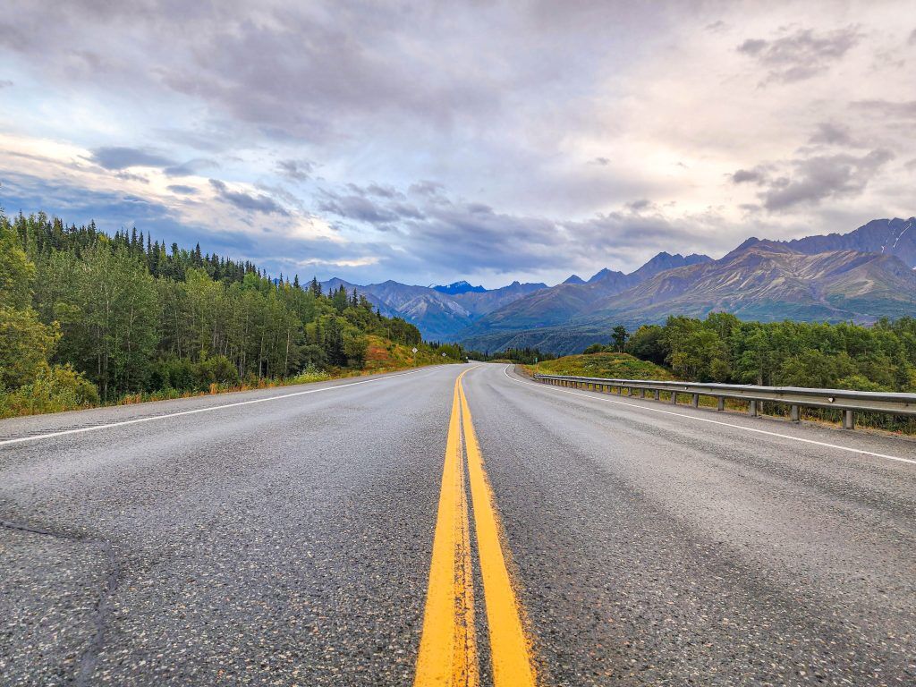
Yellow line on highway on the way to Road to McCarthy Alaska
Photo Credit: Jenn Coleman.

The McCarthy Road runs 59.4 miles from the State Wayside in Chitina (pronounced “Chit-na”) to the McCarthy Footbridge across the Kennicott River. It follows the route of the former 196-mile Copper River & Northwestern Railway, which once connected the mines to the port of Cordova.

When the mines closed in 1938, much of the track was salvaged for scrap. Floods, earthquakes, and time itself took out many bridges, leaving Kennecott and McCarthy isolated—preserved in a kind of remote time capsule that still defines the experience today.

Is the McCarthy Road Paved?

Signage on Road to McCarthy Alaska
Photo Credit: Jenn Coleman.

Mostly, no.

The McCarthy Road is primarily gravel, but for travelers willing to leave the pavement behind, it provides access to some of the most dramatic natural and historic landscapes in Wrangell–St. Elias National Park, including McCarthy and Kennecott.

Reconstruction began in earnest in the 1970s, when modern steel and concrete bridges replaced their wooden predecessors and fresh gravel was laid atop the old rail bed. What remains is rough but intentional, functional enough to reach the end, and wild enough to remind you where you are.

What Are the Road Conditions Like?

Blue bronco driving on Road to McCarthy Alaska
Photo Credit: Jenn Coleman.

The McCarthy Road is narrow and winding but relatively flat. The first few miles from Chitina toward the Copper River are paved, with occasional paved sections on steeper grades to reduce rutting.

Ironically, some of the worst potholes appear in those paved stretches, while the gravel sections are often smoother—albeit dusty and washboarded. According to the National Park Service, “under normal summer conditions, most passenger vehicles can make the trip.” That said, conditions can change quickly with weather.

How Long Does It Take to Get to McCarthy?

Highway on the way to McCarthy - Road to McCarthy Alaska
Photo Credit: Jenn Coleman.

Plan on 2–3 hours to drive from Chitina to the McCarthy Footbridge if you’re moving steadily and traffic is light. Summer weekends, especially around the Fourth of July, bring heavier traffic. It’s not gridlock, but passing opportunities are limited, and you’ll often move at the pace of the slowest vehicle.

Our advice? Drive patiently. Leave space. And when the dust gets thick, it’s often better to pull over for a photo than to white-knuckle it behind a convoy.

From Anchorage, it’s about 4.5 hours to Chitina without stops, but you’ll want to fuel up before committing to McCarthy Road. Once you park at the footbridge, it’s about a 20-minute walk into McCarthy proper.

What Is the Closest Gas Station?

Gas station - Road to McCarthy Alaska
Photo Credit: Jenn Coleman.

The closest gas station to McCarthy is in Chitina. It’s a 24-hour, credit-card-only pump with no additional services.

There is a full service station in Kenny Lake, about 90 miles from McCarthy (180 miles round trip), which offers a more comfortable fuel buffer for most vehicles. Glennallen is the last full-service town, but at 250 miles round trip, it leaves little margin unless you plan carefully, or only use it as one of the mandatory gas stops.

Can I Take a Rental Car on McCarthy Road?

Alaska 4x4 counter at Anchorage Airport
Photo Credit: Jenn Coleman.

Most national rental car companies prohibit driving to McCarthy altogether. We rented from Alaska 4×4 at the Anchorage airport and had no issues.

Not only was it permitted, but we ended up with a sweet Bronco that had excellent clearance and fresh tires. We never needed four-wheel drive, but it was reassuring to have a vehicle built for roads like this. It also made the washboard roll on the gentle cycle.

Darrish said that his guests at McCarthy Lodge Resort get scared by the warning signs at the start of McCarthy Road, but their fear isn’t justified. He said in 2006 the state DOT removed the railroad spikes by using a magnetized trailer behind a grader. When you see or read stories about taking extra tires, it’s based on 2006 and before information.

Also he said, when you see the warning sign at the beginning of McCarthy Road, telling you to take emergency equipment with you; and warning you not to travel this road because it’s “not advised” it’s important to note that’s a winter based sign!! not relevant for summer visitors!!

Is There Cell Service Along the Road?

Big bridge on Road to McCarthy Alaska
Photo Credit: Jenn Coleman.

Officially, coverage is “very limited.” Some sources go so far as to recommend carrying a satellite phone.

In practice, we had surprisingly usable Verizon service during our fall 2025 drive, though we wouldn’t count on it being consistent—or available in an emergency. Treat any cell signal as a bonus, not a plan and pay heed to the sections on car and wilderness emergency kits. Also, be sure to notify somebody you trust that you’re heading out into the wilderness, be it for hiking or driving the McCarthy Road. Darish confirmed that he finds that Verizon works on most of McCarthy Road.

What Can You See Along the Way?

Copper River Rest Area Road to McCarthy Alaska
Photo Credit: Jenn Coleman.

The McCarthy Road isn’t something to endure on the way to a destination—it is the destination.

Almost immediately after leaving Chitina, you pass through the Rock Cut, a former rail tunnel that’s now open to the sky which feels like a threshold between civilization and something wilder. At first, the road hugs the Copper and Chitina Rivers with expansive views, culminating at the Copper River Bridge.

Next, you’ll pass a chain of small lakes before reaching the single-lane Kuskulana River Bridge, often the most nerve-wracking moment for first-time drivers as you pass 238 feet above the raging Kushkulana River. The Chokosna, Gilahina, and Lakina Rivers are especially photogenic, with remnants of historic railroad trestles near the Gilihina Bridge. Long Lake lives up to its name, stretching alongside the road for more than two miles before you get your first views of the rocky Kennicott Glacier.

Darish gave us his best pro tip to truly enjoy McCarthy Road. Leaving the population centers like Anchorage Denali or Fairbanks while everyone is still asleep is a total Alaska Travel pro-tip. You’re far more likely to see wildlife along the way when the roads are empty. In addition, you’ll arrive on the McCarthy Road around 11am instead of 4pm- there’s less traffic – and you’re less likely to be behind another vehicle, even in peak July traffic.

What Services Are Available?

Available services - Road to McCarthy Alaska
Photo Credit: Jenn Coleman.

There are no service stations along the McCarthy Road, so self-sufficiency is key.

A small trading post in Chokosna sells limited snacks and drinks about halfway through the drive. Once you reach the end of the road, you’ll find espresso, food, and parking before the Kennicott River. Along the way, wayside pullouts appear roughly every 10 miles, offering parking, picnic tables, and vault toilets.

What Should You Pack in a Car Emergency Kit?

Blue bronco on Road to McCarthy Alaska
Photo Credit: Jenn Coleman.

The best emergency plan is prevention: drive slowly, check fluids, inspect tires, and make sure you have enough gas and windshield washer fluid to handle 120 dusty miles.

At minimum, you should carry:

  • A full-size spare tire
  • A working jack
  • Knowledge of how to change a tire
  • Phone charger

If you’re traveling Alaska backroads regularly, an expanded kit is wise:

What Should You Pack in a Wilderness Survival Kit?

Wilderness Survival Kit - Road to McCarthy Alaska
Photo Credit: Jenn Coleman.

With regular summer traffic, a true breakdown shouldn’t leave you stranded more than 24 hours, but preparation still matters.

Essentials include:

  • One gallon of water (for you or the vehicle)
  • Warm clothing and blankets (do not idle your car for heat)
  • No unsecured food—bear safety matters even in your vehicle (a good idea for parking too)
  • Toilet paper and a shovel
  • Essential medications
  • First-aid kit

If you’re unsure about how to keep food safe from bears, it’s best to err on the side of no food at all.

Is There an Interactive Map?

Google maps on phone
Photo Credit: Jenn Coleman.

We’re unapologetic map geeks at Coleman Concierge, so we built a custom McCarthy Road map with every stop mentioned here, and then some. We used native Google pins whenever possible for better metadata and crowd-sourced photos.

For next-level planning, open it in Google Earth to explore the terrain in 3D or drop into Street View for snapshots of the road from years past. On your phone, it works as a live navigation companion. Pair it with the National Park Service audio tour for an even deeper experience:
https://www.nps.gov/wrst/learn/photosmultimedia/audio-tours.htm

How Do You Get Into McCarthy?

Road sign on the road to McCarthy Alaska
Photo Credit: Jenn Coleman.

First: Google Maps lies.

You cannot drive directly into McCarthy proper unless you have access to a private bridge. Park at the end of the McCarthy Road and cross the footbridge on foot.

Paid parking is available at Base Camp Kennicott and McCarthy River Tours. McCarthy River Tours is slightly cheaper but farther away. Pro tip: drop passengers and luggage at the bridge first, then park. Carts are available to move bags across the bridge.

Shuttles operate from the far side of the bridge to McCarthy and Kennecott. Some activities include transportation and sometimes parking such as flightseeing with Wrangell Mountain Air, some wilderness adventures with St. Elias Alpine Guides, and stays at the Kennicott Glacier Lodge. McCarthy Lodge offers shuttle service for a fee on a per ride or per day basis. You can also walk the scenic ¾-mile road into town.

How Long Should You Stay?

Dog in McCarthy Alaska
Photo Credit: Jenn Coleman.

Our rule of thumb: stay at least as long as it takes to get there.

From Anchorage, that’s a full day each way, so plan for at least two nights in McCarthy. Fortunately, there’s more than enough to fill that time.

Two days allows for a flightseeing tour paired with rafting or hiking one day, and a glacier hike plus the Kennecott Mill tour the next. Leave time to wander Kennecott, soak up the history, and experience the Golden Saloon, the only saloon located inside a national park.

You can learn more about what to do in McCarthy from our practical guide or our photo heavy inspiration piece. You can even read both. We double dog dare you.

Are There Alternatives to Driving?

McCarthy Airport
Photo Credit: Jenn Coleman.

If the McCarthy Road still doesn’t feel right, you have options.

Flying is the easiest—scheduled service runs from Gulkana and Chitina, with charter flights available from Anchorage. It’s also the most expensive and comes with weight limits. While scenic, it doesn’t replace the experience of a dedicated flightseeing tour.

Shuttles from Chitina are another option and cost less than flying, though you still need to reach Chitina. Still, for travelers willing to leave the pavement behind, driving the McCarthy Road offers the best value—and one of Alaska’s most memorable journeys. It doesn’t just take you somewhere wild. It asks you to meet Alaska on its terms.

Disclosure: A big thank you to Alaska 4×4 for providing our awesome rental! For more Alaska 4×4 travel inspiration, check out their Instagram and Facebook accounts.

As always, the views and opinions expressed are entirely our own, and we only recommend brands and destinations that we 100% stand behind.

Ready to Book Your Trip? These Links Will Make It Easy:

Airfare:

Insurance:

  • Protect your trip and yourself with Squaremouth and Medjet
  • Safeguard your digital information by using a VPN. We love NordVPN as it is superfast for streaming Netflix
  • Stay safe on the go and stay connected with an eSim card through AloSIM

Our Packing Favs:

  • We LOVE Matador Equipment for their innovative products and sustainability focus. Their SEG45 is a game changer when you need large capacity while packing light.
  • Travel in style with a suitcase, carry-on, backpack, or handbag from Knack Bags
  • Packing cubes make organized packing a breeze! We love these from Eagle Creek

Like it? Pin it for later on Pinterest!

Hi! We are Jenn and Ed Coleman aka Coleman Concierge. In a nutshell, we are a Huntsville-based Gen X couple sharing our stories of amazing adventures through activity-driven transformational and experiential travel.


Source link